You can download a PDF version here.
Introduction
The Upland Slopes forms part of Taungurung Country. The Taungurung Clans were the first people of the rivers, valleys and mountains in this region. Before European settlement, the hills were covered in forests and open grassy woodlands dominated the valleys. The Taungurung Country Plan 2016, asserts Taungurung inherent rights as Traditional Owners of Country, and continue to be captured in Aboriginal Law despite the dispossession and dispersal of Taungurung people, who remain resilient and proud. Relevant NRM 'key concerns' documented in the Plan are: being engaged in a timely and respectful manner in decision making about activities on Country - from the beginning of decision making discussions - with regard to all aspects of Country; engaging in all aspects of Country including beneath the ground to the tops of our mountains and trees and the length of our waterways and all within them; building the capacity of our people to take an active role in decision making including natural and cultural resource management; protecting and further building traditional knowledge of land, waterways, food, flora and fauna and medicines; and ensuring the plan is used to guide and promote investment and awareness.
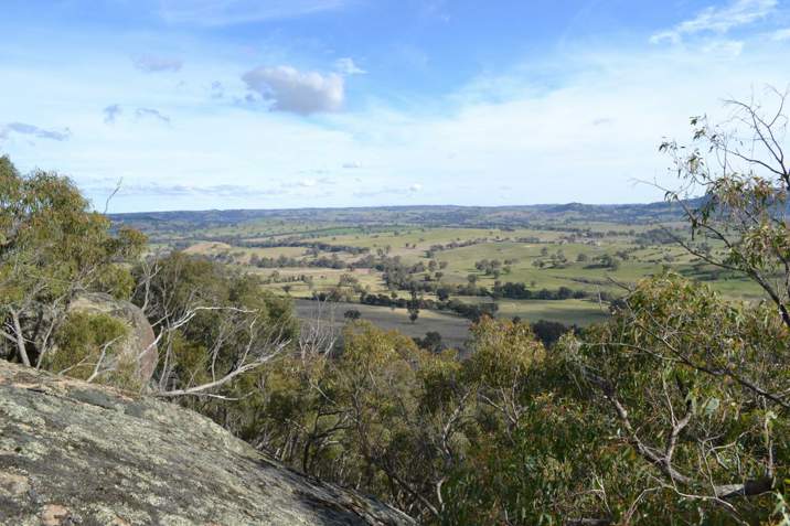
The Upland Slopes landscapes and ecosystems are now very different to how they were managed under Taungurung Law. More recently, much of this area has been dominated by agricultural land, forestry and lifestyle properties, which is reflected in subdivisions of farming land into smaller blocks.
The many waterways yield a good quality and quantity of water, which provides economic (agriculture and tourism), ecological, and social (lifestyle and and recreational (boating, fishing)) services. The remaining native vegetation is valued for the ecosystem services it provides as well as economic (tourism, forestry) and social (aesthetics, lifestyle) values it provides. Agricultural production is valued, and lifestyle opportunities of this area are increasingly appreciated by full-time and occasional residents.
The future aspiration for the Upland Slopes is an area of inspired and diverse community participating widely in sustainable agriculture and lifestyle land-use, for conservation, production and tourism outcomes.
Climate Change is one of the biggest threats to land, water and biodiversity, and is likely to have a multiplier effect on existing threats. However, the future is uncertain and this creates complexity in how best to plan for change to ensure that social-ecological systems continue to function in a desirable way. To further develop this plan, and consider climate change in planning for the future, the Goulburn Broken CMA developed a process to engage the community in local planning so that the community could make informed decisions about the way forward for their community. This process, and the actions that will now be carried out, is documented below.
From planning to Actions: Community Engagement in Local Planning
Planning within an uncertain future is inherently complex, as there are multiple, interconnected interactions between people, nature and the effects of a range of possible climate change scenarios. Resilience theory can help us plan for change in a flexible and adaptive way and drives Goulburn Broken CMA planning processes. Resilience theory explicitly recognizes that the community has a strong influence on natural resource management and that systems may change but we can manage for that change through adaptive planning. The Goulburn Broken CMA is one of the first catchments (internationally?) to implement resilience theory.
A trial of a method to develop an adaptive local plan using the key concepts of resilience thinking and ‘Adaptation Pathways’ occurred in the UPland Slopes through the ‘Bogies and Beyond’ project (Supported by the Goulburn Broken CMA through the State funded 'Our Catchments Our Communities' program). This project updates this local plan through collaboration with the community, other agencies, Traditional Owners and Social Scientists (RMIT). There were two processes run concurrently, one in the Strathbogie Ranges and one in the Mansfield region. This separation was necessary as although similar in community structure (lifelstylers and weekenders with some large, multi-generational farms), initial consultation showed that the Strathbogie ranges community have a very strong sense of living in the 'bogies, while Mansfiled residents relate much more to the High Country and not at all to the Strathbogie Ranges. The community engagement process and priority actions for the Strathbogie Ranges and Mansfield region are outlined for each sub-system below.
Strathbogie Ranges
To update this plan, 25 residents for the Strathbogie Ranges involved in four workshops to develop priority actions. In the first workshop, the group discussed what they valued about the Strathbogie Ranges, and what supports those values. This resulted in the identification of five critical attributes: 1. Productive land, 2. Water Quality and Flows, 3. native vegetation extent and quality, 4. Landscape diversity and 5. Belonging. Workshop 2 discussed what is known about these attributes, how three different climate change scenarios may affect them, and the tipping points at which the systems are likely to transform (positively or negatively). Workshop 3 and 4 developed priority actions for two of those critical attributes; 'water' and 'trees' that the group thought were the most critical to take action on now. At the end of workshop 4, there were several community members who were keen to be on 'working groups' to develop a 'tree' project and a 'water' project. These are described below.
The Tree Storey: Growback or Dieback.
The 'tree' group's main concern was that the large old trees were shoing signs of dieback, with more dead limbs and death of trees. The group developed a citizen science project that is a 'Tree Health App' that can be used by the general community to monitor the health of their trees. For more information go here https://www.gbcma.vic.gov.au/projects/bogies-and-beyond/tree-storey-citi...
'Water' project
The key outcome for the 'water' group was that the Strathbbogie Ranges community became more aware of thier water use so that demand did not exceed supply. The group wanted to learn more about three key aspects of water:
1. Groundwater
2. Waterway flows (currently measured by GB CMA and GMW)
3. The effect of dams on water flows.
The group are working with Melbourne University to understand groundwater changes in the Sevens Creek catchment above the water storage 'Polly McQuinns).
Melbourne Unviersity will also look at how we might tackle the question about the effect of dams on water flows.
Mansfield's Future Matters
The ‘Mansfield’s Future Matters’ Local SES plan was developed through a number of activities that aimed to involve the community perspectives as much as possible. Activities included workshops, attending existing meetings (eg Landcare Groups, Rotary), one on one interviews and on-line surveys.
The draft vision for the area is:
A community that cares for the natural environment and its resources for production and tourism that is ready to respond to climate change through robust governance arrangements.
The realistaion of this vision is supported by 6 critical attributes:
- Water – ground water, rainfall, catchment and rivers
- Native vegetation – extent and quality, responses to extreme events (bushfires/floods)
- Production and Farming – soils, planning for climate change, production commodities
- Landscape amenity- wide open spaces, air quality, environmental resources (lakes, rivers)
- Community – resilience to natural disasters, finding jobs, lifestyle, social/welfare divide.
- Tourism
From these critical attributes, similar to the Strathbogie Ranges Groups. native vegetation and water wre seen as the priority focus for immediate action. The priority actions for each of these two critical attributes are outlined below:
Native Vegetation Actions
Threat: A decrease in the number and health of paddock trees
Actions:
- Increase landholder knowledge about the importance of paddock trees
- Develop a resource and key messages to assist in understanding the role of paddock trees in the landscape
- Develop the importance of “Nature @ work” principles in management of paddock trees
- Increase the extent of paddock tree regeneration
- Provide seedling paddock trees to reintegrate into the landscape
- Provide opportunities/trials on best ways to fence paddock trees
- Provide understorey plants to increase the resilience of paddock trees in the landscape
- To develop biolinks for support of paddock trees
'Water' Actions
Threat: A decrease level of water in our rivers, lakes and dams and the resulting water quality as a result of climate change.
Actions:
- Decrease the overall nutrient loads in our waterways
- Provide an educative resource to assist landholders in understanding the economic value of riparian vegetation
- Work with government and private land managers to continue integration of riparian areas
- Increase resilient riparian flora species to create buffers
- Provide small incentives for landholders wanting to revegetate riparian areas including ephemeral creeks and dams
- Promote biolinks as riparian revegetation