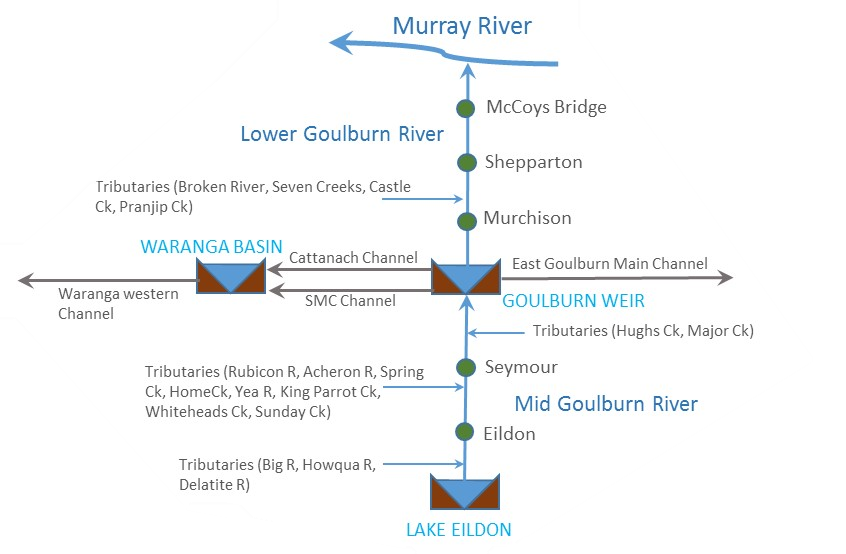
 Flows in the Goulburn River are influenced by a series of dams and weirs and regulated to deliver water for human use. River regulation has occurred since the late 1890s but water for the environment has only been actively managed in the past seven years as water has become available under the Basin Plan.
Water captured in Lake Eildon is owned by water holders including irrigators, water authorities, commercial enterprises (eg hydro-energy) and the environment. Environmental deliveries are only a small proportion of flow in the river.
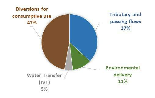
Average annual water use in the Goulburn River catchment (2011/12 to 2015/16)
The hydrograph below shows the relative proportions and sources of flow in the lower Goulburn River (between Goulburn Weir and the Murray). Environmental releases from Goulburn Weir are defined by scientific studies that identify the timing, size and frequency of flows required to improve the environmental values of the Goulburn River. You can read more about when and why water for the environment is delivered along the Goulburn River here.
Delivery of water for the environment is generally managed by adding to the flows to provide more environmentally beneficial outcomes.
View the live hydrograph
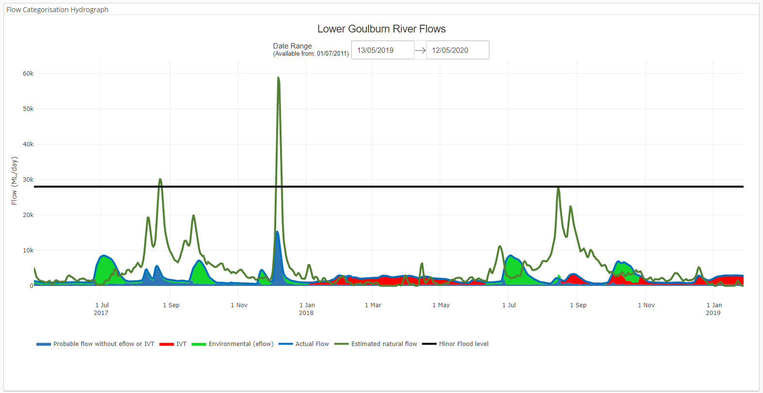 Lower Goulburn River flows from May 2019 until May 2020.
This shows the volume of water made up of the minimum flows (passing flows) released from Goulburn Weir and any inflows from rain run-off from Goulburn River tributaries below Lake Eildon. Minimum passing flows are releases by Goulburn Murray Water from Goulburn Weir to provide flow for human needs and the environment as required under water legislation. Between July and November this is 400ML/day and 350ML/day at other times. More information can be found on the GMW website.
IVT is water held by users that can be traded from the Goulburn to the Murray irrigation areas. Read more here.
This is water delivered from environmental water accounts. Read more here.
Water flowing down the river is recorded by streamflow gauging stations. The value shown here is the volume of water recorded passing the gauge at McCoy's Bridge. More information and the location of other gauges on the Goulburn River can be found here.
This value shows an estimate of the flow at McCoy's Bridge if there were no storages, weirs or channels capturing, diverting and altering flows. It uses data from inflows from Goulburn River tributaries and into Eildon.
This is the approximate flow that occurs at McCoy's bridge when the river level reaches the minor flood level as classified by the Bureau of Meteorology. Find out more about flood levels here. Deliveries of water for the environment are well below this level.
What outcomes have there been?
The following links provide information on environmental outcomes at the local, regional and Basin level:
Kaiela (Lower Goulburn River) Environmental Flows Study
The University of Melbourne recently updated the environmental flow recommendations for the lower Goulburn River.
Click here to read the final report.
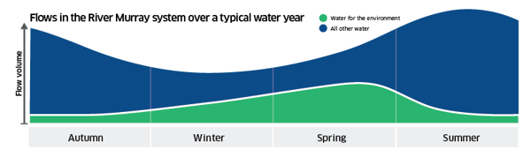
Flow in the River Murray System
Click on the image below for the MDBA's monthly point-in-time snapshot of what water (environmental, consumptive, natural) is being released down the Murray River.
Mid Goulburn Flow Study
The Mid Goulburn River FLOWS study final report: flow recommendations, is now available.
Click here to read the report
Autumn on the Goulburn
Learn how to "read" what's happening on the Goulburn River this Autumn in this informative update: Reading The Goulburn River
This is part of the Commonwealth Environmental Water Office's on-ground Monitoring Evaluation and Research Program that includes the Lower Goulburn/Kaiela River which GB CMA is a partner in: Lower Goulburn/Kaiela River