Friday, December 23, 2011
The Goulburn Broken Catchment Management Authority (CMA) is undertaking a survey and engineeringassessment of the levees along the Murray and Goulburn Rivers early in 2012.
The field survey component will be undertaken by survey and mapping companies ThinkSpatial and Water Technology on behalf of the Goulburn Broken CMA between January 2012 and April 2012.
The surveyors will be seeking assistance from all landholders to access property to traverse the levees. Landholders will be provided further information on the day of access.
Goulburn Broken CMA CEO, Mr Chris Norman, explains “The results of these assessments will help to determine the level of flood protection currently offered by the levees and identify any weaknesses. All of this data will assist emergency agencies in times of future major floods.”
“We are seeking the support of landholders along the Goulburn and Murray Rivers during this process sowe can get a better understanding of the current situation with these critical levees” continues Mr Norman.
If you would like to know more about the project please contact Guy Tierney of the Goulburn Broken CMA on (03) 58201 1100.
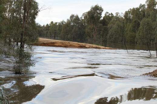
Goulburn River levee breach near McCoys Bridge, September 2010 Floods. Photo: Goulburn Broken CMA
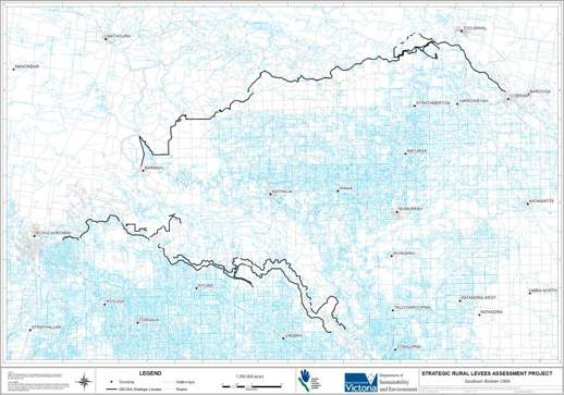
Map of the Levees to be surveyed between January and April 2012.
RELEASE ENDS
For further information please contact:
Amanda McClaren, Communications and Marketing Manager
t: 03 5820 1117 m: 0459 023 640 e: amandam@gbcma.vic.gov.au